|
|
|
|
||||||||||||||||||||||||||||||||||||||||||||||||||||||||||||||||||||||
|
|
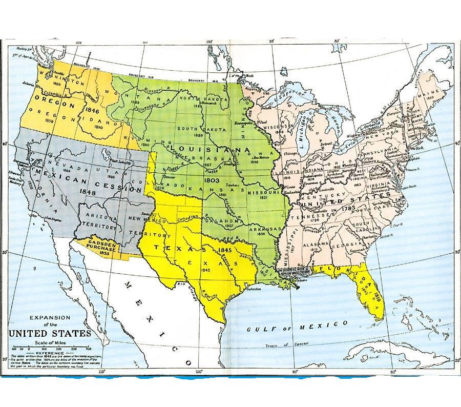
Confederate States of
America The Confederacy of the
United State is a pain in the butt to find fixed points for since the states
which defected from the Union only make it legal but had been solidly
confederate for years and in some cases decades prior. In places like New
York and around the Great Lakes they were Union only because the major cities
were Union and had a large voting block but in all hard reality were
Confederate previous to 1850 and in some
pockets are still 100% loyal to the Confederacy in the present and will never
stop being loyal to the Confederacy. New York is the headquarters of
a major branch of the Prussian Empire paramilitary spy organization the
FreiKorp, which in more than a few 1000 ways created the Confederacy. They
created the Dem Party and later the Jacksonian Party, and when their Immortal
Leader grew old and was unwilling to fight for “The Cause” any further, the
Jacksonians name changed to Confederacy which was circa 1830. The party was
originally called “Jacksonian Democrat Party”. Dixie Almost exactly a year after
the whole Joseph Smith thing occurred; this is the fixed point from where to
measure the start of the industrial revolution, the founding of what would
become the Munich Branch of the Prussian Army FreiKorp name changed to NAZI
January 1920. Almost exactly a year after the Smith events took place Andrew
Jackson died June 8,1845. Those events that took
place a year apart is what lead to the unavoidable Civil War. The American Civil War
1860-1865 are just legal dates. But the truth is much more intense.
The truth is much more detailed. Just because the powers that be say the end
of the war occurred on x date does not mean that all the areas which used to
be Confederate stayed confederate the whole 1860-1865.
In fact, places like New Orleans had been confederate since the
middle of the 1700s. New Orleans was captured by the Union in 1862, which
means that most of Louisiana was back in the Union in very short order after the
start of the War. What is also not mentioned
is how much the Pacific North West took part in the Battles. The Pacific North West
Oregon, Washington State, and Idaho divided. Washington State and Idaho
for a number of years were one state and
were about as firmly on the side of the Confederacy as was possible. But
being 2000 miles away from the closest resemblance of a wide
ranging newspaper. The Area from the Puget Sound east and south
aligning itself as a territory to the Confederacy is part of the “we do not
discuss that”. Partially because they were territories not states. The same holds true for the
Kansas, Nebraska, Colorado Territories. The large cities might have been
pro-union in pieces, portions, or parts. But large chunks of the rural areas
were about as pro-slavery as possible. Lynden, Washington had an active slave
trade occurring up until 1889 when the territory became a state. Which could
be one reason why Ted Bundy’s family moved to Seattle; to settle into a nice
pro-confederacy community in the area.
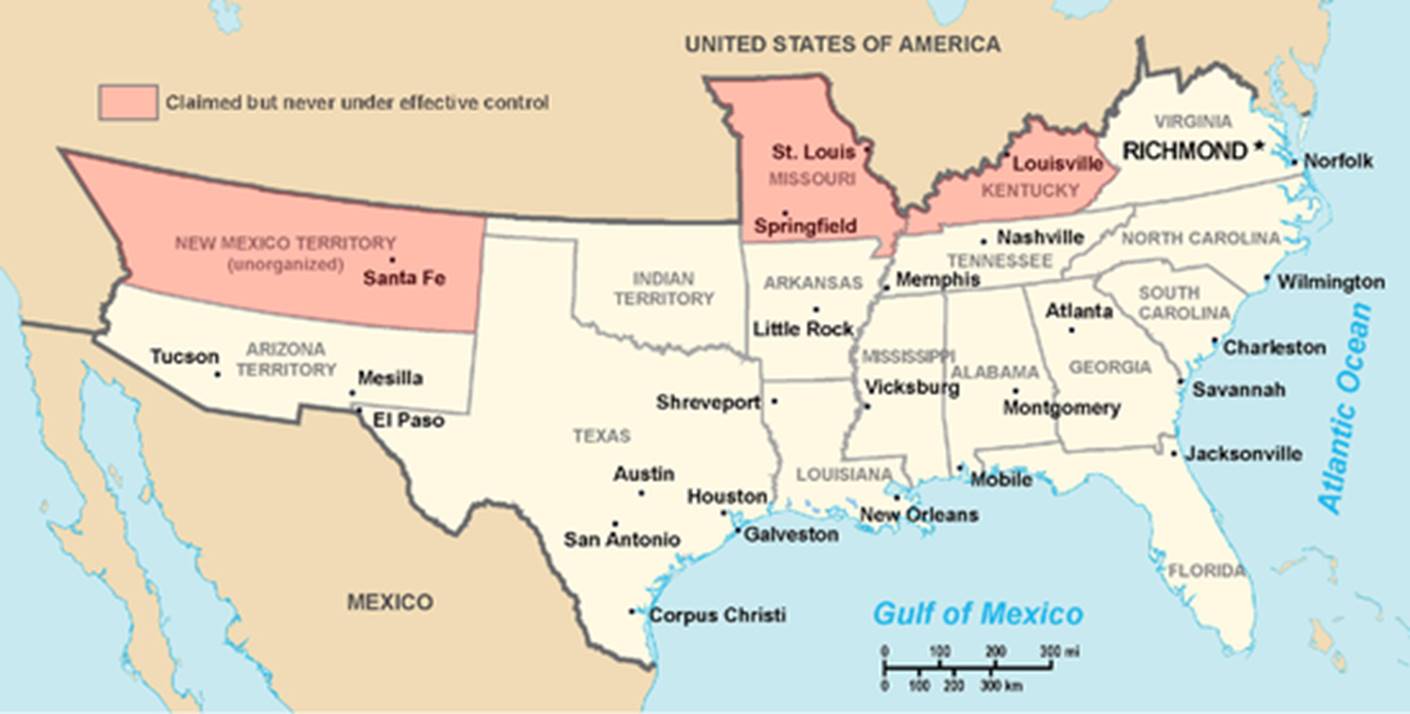
South
Carolina (December 20, 1860)[77] Mississippi (January
9, 1861)[78] Texas (February
1; referendum February 23) Virginia (April
17; referendum May 23, 1861)[85] Tennessee (May
7; referendum June 8)[87] North
Carolina (May 20)
|
|
||||||||||||||||||||||||||||||||||||||||||||||||||||||||||||||||||||||
|
|
TR Welling |
|